Senhora da Hora (Senhora da Hora)
 |
Senhora da Hora is very developed and is well connected by road, bus and Porto Metro to the nearby cities of Matosinhos, São Mamede de Infesta, Porto, Maia, Vila do Conde, the Porto Airport (OPO), and the port of Leixões all north of the Douro river. The large developed town of Águas Santas is also in Grande Porto.
Senhora da Hora is the site of the second-biggest shopping mall in Portugal, NorteShopping, with shops such as Nike, FNAC, SportZone (sports shop in Portugal), Toys "R" Us, ZARA and Massimo Dutti. It also includes restaurants like McDonald's, Pizza Hut and KFC. There is also a cinema with eight screens.
A public swimming pool was recently built near NorteShopping inside a small natural park.
The well-known Pedro Hispano Hospital is also located there.
The metropolitan transport service of Porto Metro passes through the centre of Senhora da Hora and the station is one of the most important stops on this public transport system with connections to other lines and road transport.
Map - Senhora da Hora (Senhora da Hora)
Map
Country - Portugal
 |
 |
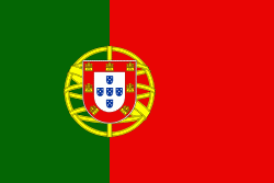
| Flag of Portugal | |
One of the oldest countries in Europe, its territory has been continuously settled, invaded and fought over since prehistoric times. The territory was first inhabited by pre-Roman and Celtic peoples who had contact with Phoenicians, ancient Greeks and Carthaginians. It was later ruled by the Romans, followed by the invasions of Germanic peoples and the Islamic invasion by the Moors, whose rule was eventually expelled during the Reconquista. Founded first as a county of the Kingdom of León in 868, gained its independence as the Kingdom of Portugal with the Treaty of Zamora in 1143.
Currency / Language
| ISO | Currency | Symbol | Significant figures |
|---|---|---|---|
| EUR | Euro | € | 2 |
| ISO | Language |
|---|---|
| PT | Portuguese language |


